Urban Planning
Parcels, permits, massing and FAR, change over time — the city read as a living digital twin, not a static map.
A geospatial-AI platform for operators — see the ground, name what’s on it, and act on it together, inside a private network that’s yours alone.
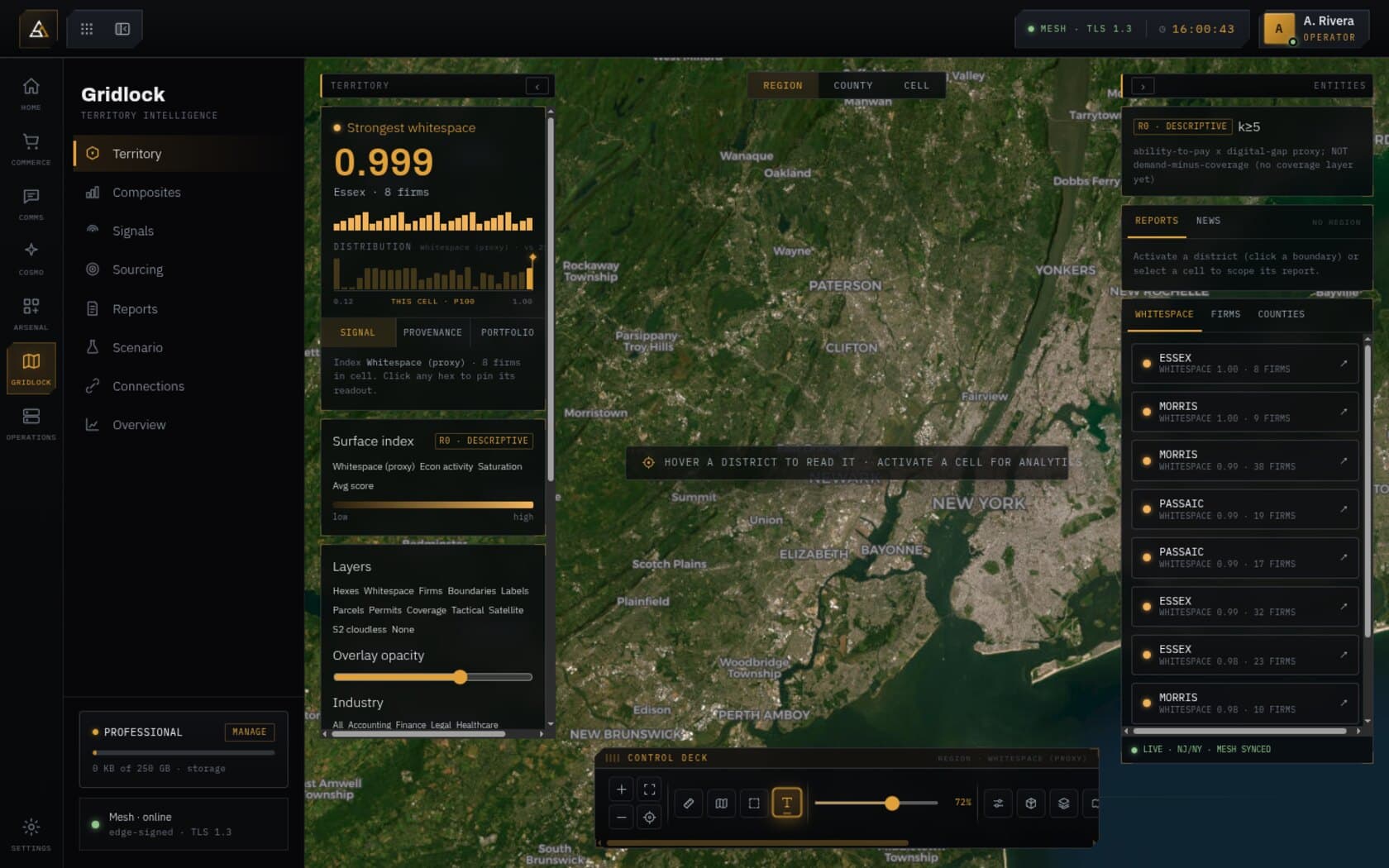
Gridlock turns a territory into a decision layer. A living deck.gl / H3 model sits over a bitemporal object layer of parcels, permits, and firms, and every cell is scored for composition, whitespace, and absorption — so you read a place by what it's made of and where it's heading, not by how it looks on a map.
It's the substrate the rest of the platform runs on. Vision perceives change from above, Cosmo explains the read cited back to its layers, and your own data and simulations run in a private network that's yours alone — one model an operator can analyze, simulate, train, and decide on.
Parcels, permits, and firms as first-class objects — queryable, joinable, and versioned, not pixels on a tile.
Composition, whitespace, absorption, and permit velocity, computed on an H3 grid cell by cell.
Every fact carries when it was true and when we learned it — the territory read as it changes over time.
Parcels, permits, massing and FAR, change over time — the city read as a living digital twin, not a static map.
Whitespace — demand where there's no coverage — plus composition and absorption, ranking candidate sites.
Prospects sit on the grid: a k-anon geo-join attaches each one its cell's composition and a deal evaluation.
Business and economic mix, SMI, absorption, permit velocity — a territory's economic pulse, cell by cell.
We use geospatial and market data to analyze, simulate, train, and collaborate — so operators turn territory into decisions across the whole team.
Score territory from geospatial and market data — composition, whitespace, absorption, and signals, cell by cell.
Model how a territory behaves under change — new supply, absorption, massing — before you commit.
Bring your own data and tune the models to your territory — Vision and Cosmo, trained on what you know.
Share live intelligence across the team on a private network — decisions made together, not in silos.
One site, four moves. The view never changes — each phase adds a layer to the same ground, so the operator who surveyed it is looking at the record the partner will act on.

Two arms — perception and reasoning — over the same territory. The platform sees space, then explains it.
Satellite and aerial object recognition — construction, new lots, change over time — corroborated by permit signals.
Reads across the grid, the prospect graph, and your own data, returning a sourced reading cited back to its layers.
Each member operates in a private namespace — bring your own data, simulate a territory's behavior, and run Vision — all isolated. It rides real private infrastructure, so “private network” is architecture, not marketing.
MLS/RESO, economic, and custom feeds enrich your composition in a private namespace.
Model how a territory behaves under change — new supply, absorption, massing — before committing.
Your data, simulations, and Vision runs never touch another member's.
Intelligence isn't a document you receive. Operators hold positions on the same live terrain, see each other's presence, and work a session together — one territory, one objective set. What one desk resolves, the party can read.

Every operator carries a position on the same live terrain and a standing on the network — live, online, or idle — so you know who is on the ground before you commit a move.
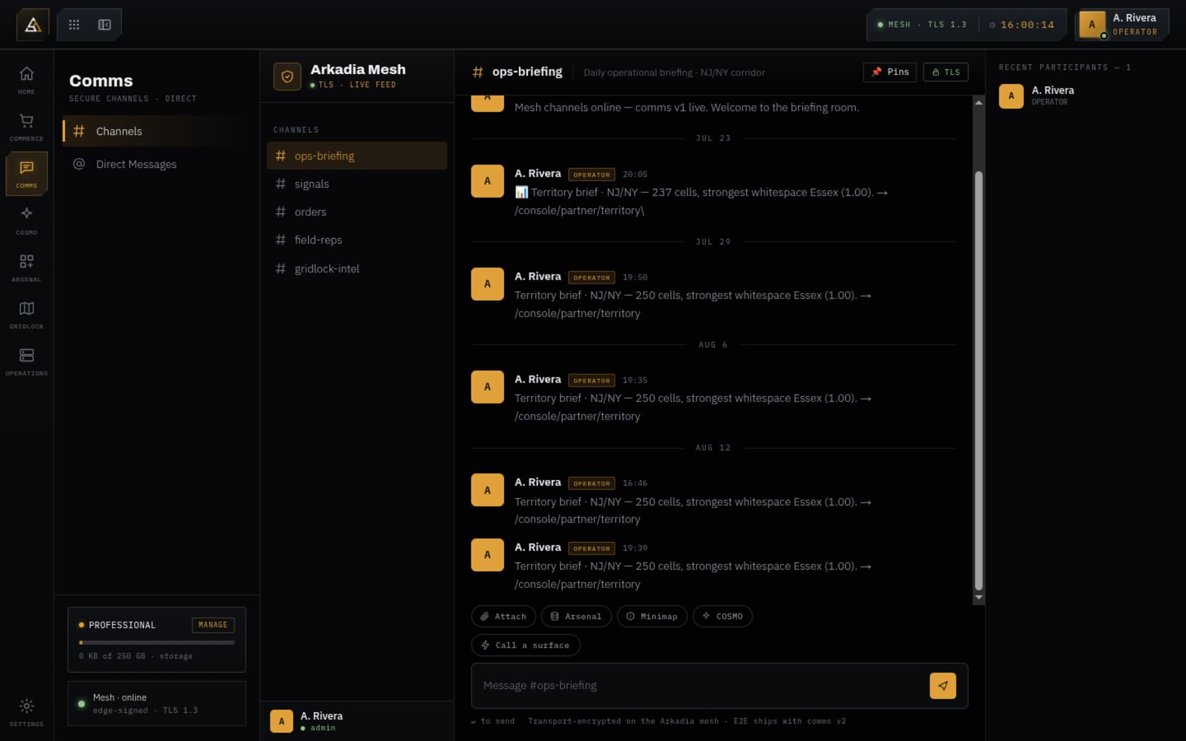
Spaces, channels, and direct messages on the private mesh. Call a live capability surface into a thread and the data travels with it, not a screenshot.
Shared drives and deal rooms issue access by document, not by folder. Every read is recorded against the reader, and an export produces a sealed evidence pack.
Territory extracts, corridor readings, and analysis move between members as leased surfaces — settled on the console ledger against your node address.
Sign in and the platform routes you into the console; your membership tier decides which surfaces unlock.
Get on the map. The public territory view, comms, and your own drive — to see what the platform reads.
The full intelligence desk for one operator — live territory analytics, the AI agent, and your own comms.
Team intelligence — the full platform with Vision, simulation training grounds, and a private network of your own.
A members-only exchange where access is gated end to end. Connections and secrets live in an isolated store, never in the shared application data — and this is what the platform delivers.
Encrypted in transit (TLS) end to end; member-to-member messaging delivered with Messaging Layer Security (MLS) over AES — sealed so only the participants can read it.
Every member runs in a private namespace — your data, simulations, and Vision runs are computed and stored apart, never mingled with another member's.
Bring your own keys: member API credentials for business intelligence (MLS/RESO and custom feeds) resolve through encrypted vaults, so provider data at rest stays under your control, isolated from the shared store.
Prospect geography is k-anonymized and contact PII is redacted until territory-routing authorizes it — intelligence you can act on without exposing individuals.